 I. CASE
BACKGROUND
CASE NUMBER: 74
CASE MNEMONIC: IRANIRAQ
CASE NAME: Iran-Iraq War and Waterway Claims
CASE AUTHOR: Brad Martsching, May 1998
 I. CASE
BACKGROUND
I. CASE
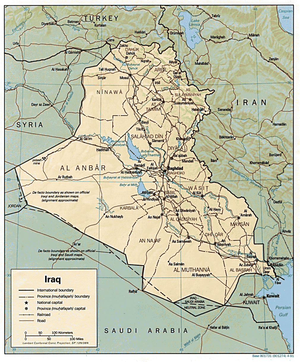
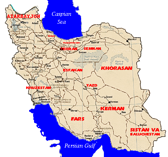
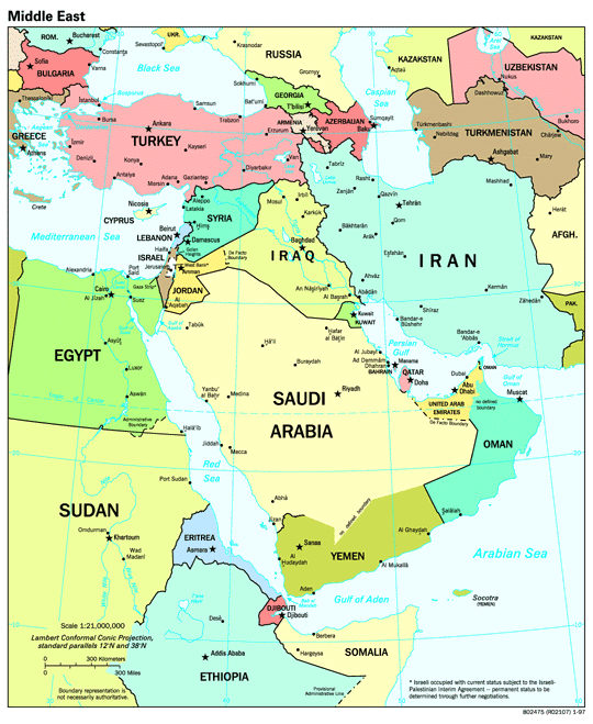
BACKGROUNDIn 1980 war erupted between Iran and Iraq. This war resulted in hundreds of thousands of casualties and a tremedous loss of oil revenues for both countries The war eventually ended in 1988 but anomosities have persisted. While the causes of the conflict were numerous and varied, one of the principals was access to, and control of, the Shatt-al-Arab waterway. Control of the waterway and its use as a border have been a source of contention between various states since The Peace Treaty of 1639. Ambiguities in this agreement (between the Persians and the Ottoman Empire) led to continual disputes that have not been resolved to this day. See maps of Iraq and Iran respectively below.
Issues


Iran and Iraq have a number of longstanding enmities that actually precede the formation of either country. The first of these is Iran is the inheritor of the Persian empire while Iraq is the inheritor of the Babylonian Empire. This is significant if for no other reason than it means Iranians identify themselves as Persians while Iraqis identify themselves as Arabs. Consequently the majority of Iranians speak Persian dialects while the vast majority of the Iraqi population speaks Arabic. These differences are further highlighted when one examines differences in religion.
While both countries are Islamic, the government of Iran is of the Shi'a sect while Iraq is of the Sunni.
Furthermore the Iraqi ruling party, the Ba'th regime, is secular while the Iranian government is fundamentalist.
This is further complicated by the fact that although the Iraqi government is Sunni, the population is from
60%-65% Shi'a. The Iranians attempted to capitalize on this fact by embarking on a campaign designed to enflame
the Shi'a population of Iraq and subvert the Iraqi government in 1979-80. The Iraqi's responded by increasing
their military readiness posture thus starting a conflict spiral that eventually resulted in the outbreak of
hostilities.
Throughout the conflict both sides played upon the differences outlined above to maintain the support of
the domestic population and elicit the support of foreign governments. Neither country was very effective in
the latter.
This treaty also had problems and "suffered from a
central weakness: it remained largely nebulous in its working
and was unclear about the course of the border in the Shatt-al-Arab
region, thus leaving unresolved the question of territorial
responsibility for the eastern bank of the river."(3) Not
surprisingly this treaty also proved insufficient and led
to The Constantinople Protocol of 1913. This treaty established
a commission to mark the border but this work was ended with the
outbreak of WWI and prevented recognition of the border.
It was in the aftermath of WWI (and the subsequent border deliniations
on the part of the British) that the dispute was first
placed in an Iran-Iraq context. This resulted in a treaty between
the two countries in 1937 and a commission to determine the border
in 1938. This met with many of the problems mentioned earlier and
little progress was made until the 1950s. However, just as it
appeared that a lasting agreement might be reached, a revolution
occurred in Iraq and the situation deteriorated. A number of armed
clashes took place along the border but these were fairly minor.
By 1969 the situation in the region had changed such that
Iran was vastly superior (in military terms) to Iraq. This was due in
part to the fact that the Ba'th party had recently taken power and was tied up domestically
ensuring its power base within the country. Reportedly the Iranians
supported the Kurdish uprising in the northern sector of the country
and brought the countries to the verge of open warfare again. This
was averted by The Algiers Agreement of March 1975 which was
forced on the Iraqi's due to their inferior military position. This
agreement established the border along the thalweg principle
(mid-river) and was later rejected by Iraq. This set the stage for
conflict that would erupt in 1980. (In regards to navigation rights,
Iraq wanted access to the full width
of the river as it is crucial to its exports. However the Iranians preferred
a delineation along the aforementioned thalweg principle.)
Iraq, which relies primarily on oil exports to generate
foreign exchange earnings, suffered severe losses during the
war. This was due not only to the "massive expenditures"required
to finance the war, but damage to oil export facilities.(4) Both sides
specifically targeted these facilities in an attempt to reduce dramatically
the others ability to wage war. The Iraqi losses alone are
estimated to be at least $100 billion.(5)
With the cessation of hostilities in 1988 the Iraqi economy
began improving steadily as oil export facilities were rebuilt and new
pipelines constructed. This ended shortly after the invasion of
Kuwait with the introduction of an international embargo and military
action soon after. Today oil exports remain at approximately 5% of
their previous level and living standards have deteriorated.(6)
For example, the latest economic figures available (1996) estimates Iraq's GDP at $42 billion and Iran's at
$352 billion (both in U.S. dollars). Likewise per capita GDP was estimated at $2000 for Iraq and $5300 for Iran.
For a more detailed examination of the impact of sanctions on Iraq see
In regards to the river the economic impact is immense. In
the words of one author, "there is no doubt at
all that for the Iraqis unopposed usage of the Shatt waterway and
of the small stretch of Iraqi territory debouching on the Gulf is seen,
in economic and security terms, as vital."(7) This is because
the river and this small stretch of land is the Iraqis only outlet to the
Persian Gulf and thus the shipping lanes needed to exports it primary
resource, oil. Once again this arrangement is a result of direct British
influence as they served as a hegemon for the region through the end of WWII.)
The United Nations made numerous attempts to intervene in the conflict and
end the hostilities but all attempts failed.
While the potential for environmental damage remained high throughout the course of the conflict,
apparently little took place. There are some allegations that Iranian access to water resources was
restricted during the period of Iraqi occupation, but no concrete evidence has been produced.
Transportation along the Shatt-al-Arab was however restricted throughout the duration of the conflict.
The Shatt itself is important for a number of reasons. The first is that it allows for agricultural production
in an area with a dry, humid climate. The waterway then serves as a means of transportation for moving
agricultural and other products both within the country and to ports for export. This last part is of strategic
importance to Iraq which is land-locked except for the narrow strip which runs along the Shatt. Furthermore,
the majority of that strip of land is swamps and therefore not conducive to a large number of highways or
railroads without a significant expenditure of economic resources.
While there is no one definitive estimate, several have been made with nearly all placing the number of
casualties well over 100,000 (on each side).
In this case there is a direct link between the environment
and the conflict. In the words of one author, "there is no doubt at
all that for the Iraqis unopposed usage of the Shatt waterway and
of the small stretch of Iraqi territory debouching on the Gulf is seen,
in economic and security terms, as vital."(7) While there were a
number of additional factors that contributed to the conflict, the
importance of the waterway cannot be overstated.
The Iran-Iraq war ended at the end of eight years with neither country having gained a clear advantage.
Iraq's initial invasion met with a good deal of success but eventually became bogged down and was unable
to capitalize on its early successes. (This was due in part to withdraw of support by the U.S.S.R. which had
not been informed prior to the invasion.) While each side made significant gains from time to time, neither was
able to sustain the combat power needed to reach the other's center of gravity and achieve decisive victory.
Diplomatic relations were restored in 1990 but they "are still trying to work out written agreements settling
outstanding disputes."(8) Iraq also has a dispute with Turkey over water development plans
for the Tigris and Euphrates rivers.
Update: Relations between the two countries have
recently been warming and could lead to an agreement. They have
also started to exchange prisoners of war from the conflict with
over 5500 being exchanged in April.(9)
ICE Cases
Nebuchadnezzer's Defense of Babylon
Environmental and Economic Repercussions of the Persian Gulf War on Kuwait
(1)For example, "Among the complaints lodged by Iraq and Iran with the United
Nations before September 21, 1980, the issue of the river frontier is markedly absent." See Ford
Foundation Conference Report, The United Nations and the Iran-Iraq War, New York:
Ford Foundation, 1987, p. 11.
(2)See Daniel Pipes, "A Border Adrift: Origins of the Conflict," in The Iran-Iraq
War, as quoted in W. Thom Workman, The Social Origins of the Iran-Iraq War, Boulder:
Lynne Rienner Publisher, Inc., 1994, p. 23.
(3)See Peter Hunseler, "The Historical Antecedents of the Shatt al-Arab Dispute,"
ed. M.S. El Azhary, New York: St. Martin's Press, 1984, p. 11.
(4)See the CIA website, "The World Factbook on Iraq," p. 4 of 7. Downloaded on
January 5, 1998 from:
http:/www.odci.gov/cia/publications/factbook/
(5)Ibid.
(6)Ibid.
(7)See Glen Balfour-Paul, "The Prospects for Peace," in The Iran-Iraq War:
An Historical, Economic and Political Analysis, ed. M.S. El Azhary, New York: St. Martin's Press,
1984, p. 129.
(8)Found on the CIA website, "The World Factbook on Iraq," p. 1 of 7. Downloaded
on January 5, 1998 from:
http:/www.odci.gov/cia/publications/factbook/
(9)See Doug Struck, "POW's Story a Reminder Of the Brutal Iran-Iraq War,"in
The Washington Post, April 12, 1998. p. A22, and
Douglas Jehl, "Iran and Iraq Begin Big Trade of P.O.W.'s," in The
New York Times, April 7, 1998. p. A3.
Balfour-Paul, Glen. "The Prospects for Peace," in The Iran-Iraq War: An Historical, Economic and
Political Analysis, ed. M.S. El Azhary, New York: St. Martin's Press, 1984.
Blake, Gerald H. and Richard Schofield. eds. Boundaries and State Territory in the Middle East and
North Africa. Cambridgeshire: Middle East and North African Studies Press Ltd., 1987.
Bulloch, John and Adel Darwish. Water Wars: Coming Conflicts in the Middle East. London:
Victor Gollancz, 1993.
Ford Foundation Conference Report. The United Nations and the Iran-Iraq War, New York:
Ford Foundation, 1987.
Hunseler, Peter. "The Historical Antecedents of the Shatt al-Arab Dispute," ed. M.S. El Azhary, New
York: St. Martin's Press, 1984.
Jehl, Douglas. "Iran and Iraq Begin Big Trade of P.O.W.'s," in The
New York Times, April 7, 1998. p. A3.
Kaikobad, Kaiyan Homi. The Shatt-al-Arab Boundary Question: A Legal Reappraisal, Oxford:
Clarendon Press, 1988.
Khadduri, Majid. The Gulf War: The Origins and Implications of the Iraq-Iran Conflict. New
York: Oxford University Press, 1988.
Pipes, Daniel. "A Border Adrift: Origins of the Conflict," in The Iran-Iraq War, as quoted in W.
Thom Workman, The Social Origins of the Iran-Iraq War, Boulder: Lynne Rienner Publisher, Inc.,
1994.
Roberts, Ann Milne. "Water Wars of Water Laws," in the Financial Times,
August 28, 1997. pp. 12-13.
Schofield, Richard N. Evolution of the Shatt Al-' Arab Boundary Dispute. Cambridgeshire:
Middle East and North African Studies Press Ltd., 1986.
Struck, Doug. "POW's Story a Reminder Of the Brutal Iran-Iraq War,"in
The Washington Post, April 12, 1998. p. A22.
Peace Treaties Related to the Shatt-al-Arab
The first recorded treaty that involved the Shatt-al-Arab was
The Peace Treaty of 1639 between the Persian and Ottoman
Empires. This treaty established a border lacking in detail and
conforming in large part to tribal loyalties. While this arrangement
proved sufficient in most areas, this was not the case in the
Shatt-al-Arab region. From the Persian perspective the waterway
served as a natural border. However, the tribes on both sides
were Arabs and thus the Turks viewed the entire area (both sides) as
belonging to them. This led to the outbreak of hostilities in the
1800s and eventually yielded The Second Erzerum Treaty of
1847.
Economic Impact
3. Duration: 1980-88
4. Location

Continent: Africa
Region: Middle East
Country: Iran
5. Actors: Iran, Iraq, and the United Nations
 II. ENVIRONMENTAL ASPECTS
 6. Type of Environmental Problem: Water
7. Type of Habitat: Dry
8. Act and Harm Sites:
Act Site                Harm Site

Iran-Iraq border        Iran-Iraq border
 III. CONFLICT
ASPECTS
III. CONFLICT
ASPECTS9. Type of Conflict: Interstate
10. Level of Conflict: High
11. Fatality Level of Dispute:
 IV. ENVIRONMENT AND CONFLICT OVERLAP
12. Environment-Conflict Link and Dynamics: Direct
==> historical claims ==> CONFLICT
==> power imbalance ==> CONFLICT
==> resource demand, water ==> CONFLICT
13. Level of Strategic Interest: Regional
14. Outcome of Dispute: Draw
 V. RELATED
INFORMATION AND SOURCES
V. RELATED
INFORMATION AND SOURCES15. Related ICE and TED Cases
16. Relevant Websites and Literature
Endnotes
Relevant Literature
May, 1998